Beach and karst
Ao Nang Beach Audio Guide (Hat Ao Nang)
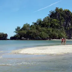
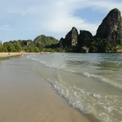
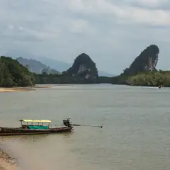
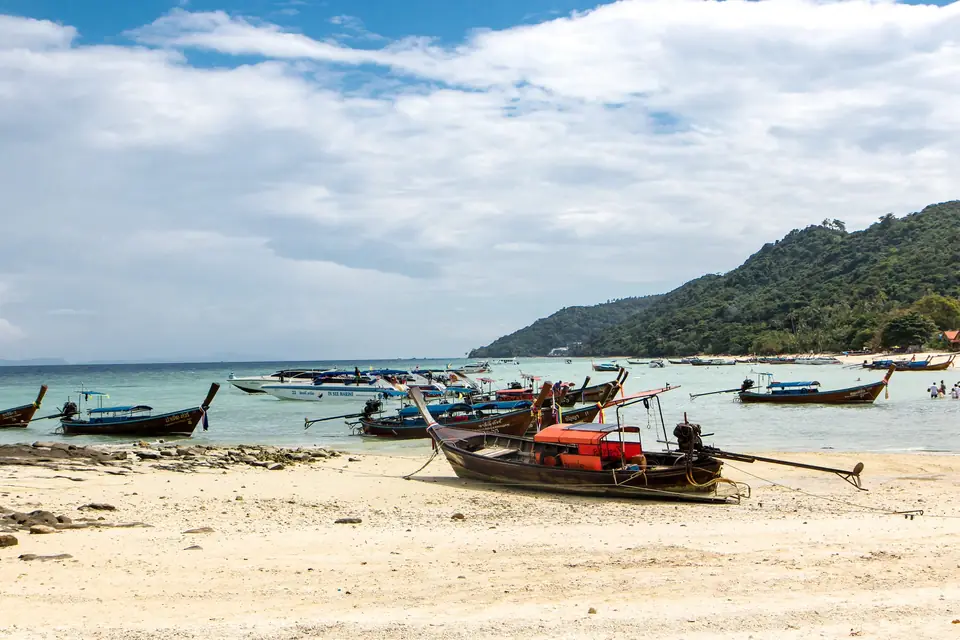
A beach with no pier, where long-tail boats load passengers right on the sand, among limestone towers born of an ancient sea. A fishing village that became the great tourist showcase of Krabi province.
- 45 min of audio
- Beach and limestone towers
The formal name of the place is Ao Phra Nang, the “Princess Bay”, although everyone uses the short form: Ao Nang. By around 2005 the old fishing village had already become one of Thailand's major tourist destinations. The first travellers to put it on the map were backpackers who came to climb the karst formations of Krabi, with most of the routes at Railay, Ton Sai and Phra Nang. Since 1999 Krabi International Airport has served the province, and its proximity turned Ao Nang from a backpacker refuge into a more upmarket destination.
The beach has no pier: the long-tail boats leave and arrive at both ends, and passengers get wet when boarding, their feet at the very least and probably more. The crossing to Rai Leh West and Ton Sai takes about 10 minutes. Behind that postcard, the drain that fouled the boarding sand in 2017 and a comprehensive sewerage scheme that was still stalled that year are reminders that tourist success has a less visible side.
Highlights
- No pier — Long-tails board on the sand at both ends and the crossing to Rai Leh West and Ton Sai takes about 10 minutes
- Khlong Haeng — The “dry stream” and its bridge, where Ao Nang Road becomes Nopparat Thara Road
- Tsunami warning tower — Sirens beside the marlin statue, in the shadow of 26 December 2004
- High season — From 1 November to 30 April, with façade demolitions from 1 May
- Limestone cliff — Limestone formed from the skeletons of marine organisms and later sculpted by rain
Ao Nang Beach is, for a good many travellers, simply “Krabi”. Its formal name is Ao Phra Nang, the “Princess Bay”, and the short form is the one everybody uses. By around 2005 the quiet fishing village already ranked among the great tourist destinations of Thailand, and today it works as the province’s main showcase: a beach with no pier, a continuous front of shops, restaurants and excursion agencies, and behind it, limestone towers that the sea left as an inheritance.
The history of Ao Nang Beach can be read in layers. First came the backpackers looking for climbing routes in the Krabi karst; then, from 1999, Krabi International Airport brought the province closer to the rest of the world and the place went from backpacker refuge to more upmarket destination. Understanding what to see at Ao Nang Beach means following that route of five stops, from the stream at the west end to the cliff at the east end, with the EarGuide audio guide as company. That same bay stretches north into Nopparat Thara Beach, and the long-tails leaving Ao Nang cross over to Railay West Beach and Phra Nang Cave Beach, whose princess gives the bay its name.
A dry stream that changes the names
Khlong Haeng
Summary of this stop
The route starts on the south bank of the Khlong Haeng, the “dry stream”, a small watercourse that cuts the coast at the west end. Together with an impassable headland, it separates Ao Nang Beach from Nopparat Thara Beach. A bridge crosses the channel, and on that bridge Ao Nang Road becomes Nopparat Thara Road: an administrative detail that marks, very literally, where one place ends and another begins.
The name of the beach holds another layer too. Ao Phra Nang translates as “Princess Bay”, although the meaning of “Phra Nang” is disputed: the reading as “Princess” coexists with the identification of Phra Nang as a local goddess venerated in a cave on the Railay peninsula, and neither the etymology nor the associated legend has solid documentary backing.
In everyday traveller speech, according to a popular belief, Ao Nang is often called simply “Krabi”, even though the provincial capital is a different town. How one beach ended up with the name of an entire province is something the narration unfolds right there.
Ribbons on the bow, islands on the horizon
Long-tails beached on the sand
Summary of this stop
At the long-tail boarding point at the west end, wooden boats wait beached on the sand. There is no pier: passengers climb aboard with water up to their legs, and the boats leave and arrive at both ends of the beach. The crossing to Rai Leh West and Ton Sai takes about 10 minutes.
The high bows carry coloured cloths tied to them. According to the tradition of Thai fishermen, the bow is the home of Mae Ya Nang, the female spirit who guards the vessel, and before going out to fish she is given offerings of cloth, flowers and incense. The ribbons fluttering on each bow would, in that reading, be the offering to the boat’s invisible owner.
On the horizon the silhouettes of limestone islands stand out: the Ko Poda group, made up of Ko Poda, Ko Kai, Ko Mo and Ko Thap, about 8 km from Ao Nang, and beyond it Ko Hong. The Mu Ko Poda archipelago is managed by Hat Noppharat Thara–Mu Ko Phi Phi National Park, created in 1983, which protects 388 km² with coral reefs. The link between the sand and that protected sea is one of the threads of the audio guide.
The siren tower and the wave of 2004
Marlin statue
Summary of this stop
Facing the promenade, beside Ao Nang Road, stands a marlin sculpture, and next to it a metal tower with sirens for tsunami warnings. Right in the middle of the postcard, that tower invites a different way of looking at the sea: the tsunami of 26 December 2004 caused extensive damage on the Krabi coast, and the province counted 476 dead as of 7 January 2005.
The hotel tally five weeks later draws two worlds inside the same municipality. According to the records of the time, on 1 February 2005 the Phi Phi Princess Resort was still closed and did not expect to reopen for at least two years, while on Ao Nang Beach the Ao Nang Beach Resort, the Ao Nang Villa Resort, The Cliff Ao Nang, the Ao Nang Buri, the Ao Nang Paradise and the Best Western Aonang Bay were operating normally.
That difference matters because the tambon of Ao Nang is divided into 8 villages and number 7 is Ban Ko Phi Phi: the Phi Phi Islands, Maya Bay included, depend administratively on Ao Nang. A long legal dispute is also set there: in 1999 the provincial and tambon administrations sued those who had authorised 20th Century Fox to film The Beach at Maya Bay, claiming 100 million baht for environmental damage, and the Supreme Court set the reading of the ruling for 13 September 2022, 23 years later.
Façades that come down every first of May
Ao Nang Road promenade
Summary of this stop
The Ao Nang Road promenade is a continuous front of shops, restaurants and excursion agencies pressed against the beach, the visible face of the tourist transformation. High season runs from 1 November to 30 April; on 1 May the demolitions begin, and many commercial façades are knocked down to put up new ones before the next season. The showcase, in this way, works as a stage set that is rebuilt every year.
Beneath that set appears the less visible side of success. On 8 February 2017, tourists and long-tail boatmen reported black sewage coming out of a drain, pooling on the beach and flowing into the sea, right where passengers wait to board.
Ao Nang’s comprehensive sewerage scheme, requested by the Tambon Administrative Organisation since 2008, was still stalled in 2017 because it required more than 300 million baht. The existing treatment plant handles about 3,000 m³ of wastewater a day, an insufficient capacity. What remains of that tension between postcard and drain is what the narration poses in front of the promenade itself.
The wall born of marine skeletons
Limestone cliff at the east end
Summary of this stop
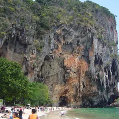
The route ends beneath the limestone cliff at the east end, a vegetation-covered wall that closes off the beach, marks the way towards Railay and is the nearest example of the karst towers of Krabi. It is also the stop that tells the longest story of the itinerary.
The limestone of this coast was formed from the calcium carbonate of the skeletons of marine organisms deposited in a shallow sea hundreds of millions of years ago. Later, rain, slightly acidic in the tropics, sculpted it into towers. That rock explains why the climbers arrived first, with their routes at Railay, Ton Sai and Phra Nang, and the aeroplanes later, with the international airport opened in 1999.
From the sea that created the wall to the sea that now washes the boarding sand, the final stop closes the circle of the beach, and the most surprising detail is saved for the audio guide at the spot itself.