Prehistory and mangrove
Khao Khanab Nam Audio Guide
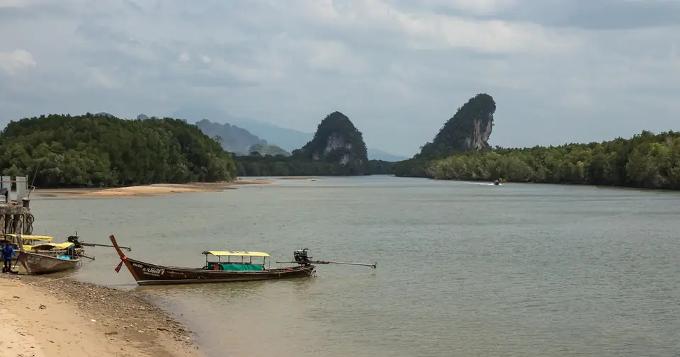
Two limestone towers about 100 metres high face each other across the mouth of the Krabi River. At their feet, a rock shelter keeps the trace of a higher sea and of the prehistoric fishers who lived beside it.
- 60 min of audio
- Prehistory and mangrove
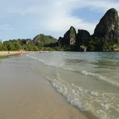
Khao Khanab Nam are two limestone hills about 100 metres high, one on each bank of the Krabi River, in the Pak Nam subdistrict. They are the popular emblem of the province, although the official seal prefers some ancient swords and Mount Phanom Bencha. The present-day town was built in 1900 right opposite them, when the governor moved the provincial seat here.
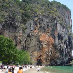
At the base of the hill, a rock shelter measuring 23 by 7 metres preserves a wave-cut notch at a height of 5 metres: the mark of a sea that between 6,000 and 5,000 years ago stood that high. Excavations took place there in 1979 and 1999, and a strip was deliberately left untouched there for future archaeologists.
Highlights
- Two limestone towers about 100 metres high face to face
- Sea notch at 5 metres: the sea of some 6,000 years ago
- Rock shelter excavated in 1979 and 1999
- Unexcavated strip reserved for future archaeologists
- Cave with amulets of King Bhumibol linked to its history
The history of Khao Khanab Nam begins long before Krabi Town existed. The two limestone hills, about 100 metres high, flank the Krabi River in the Pak Nam subdistrict, and at their feet opens a rock shelter that was excavated in 1979 and in 1999. Anyone looking for what to see at Khao Khanab Nam finds a route that combines archaeology, geology and mangrove: a wave-cut notch that recalls a higher sea, remains of prehistoric meals and a cave from which the skeletons were removed. The full experience is best enjoyed by walking the site with the audio guide, which saves the most striking detail for each point. Around the town of Krabi, the same limestone opens into caves such as that of the Tiger Cave Temple, and about 7 km away the Fossil Shell Cemetery shows another layer of the coast’s geological history.
An emblem that is not on the seal
Chao Fa Pier
Summary of this stop
The route starts at Chao Fa Pier, looking upriver. From there the two towers appear as a silhouette framed between both banks, which is why they are the popular symbol of Krabi province. The present-day town stands on precisely this spot: in 1900 the governor moved the provincial seat from Ban Talad Kao to the river mouth, opposite the two hills.
The paradox lies in the official seal. It does not show the towers, but two crossed ancient swords, the “krabi” found in the province, before the sea and Mount Phanom Bencha, the highest peak in the region, with five summits. An emblem of the people on one side, an institutional shield on the other: a local custom that the narration develops right there on the pier.
A hundred metres of rock above the mangrove
Floating pontoon at the foot of the hill
Summary of this stop
From a floating pontoon at the foot of the hill the scale changes. What from the pier was a silhouette becomes a sheer wall of about 100 metres, and on both banks a mangrove stretches out, its roots poking up at low tide.
This estuary has been Ramsar site number 1100 since 5 July 2001: 213 km² protected, of which more than 100 km² is mangrove. The stop places the visitor between the rock and an ecosystem that breathes with the tide.
The line left by a higher sea
Notch of the ancient sea level
Summary of this stop
At the base of the hill opens a rock shelter measuring 23 by 7 metres, right against the river, whose floor lies about 1.5 metres above high tide. On its wall, 5 metres above the base, runs a smooth notch carved by the waves.
That line is the trace of a time when the sea stood about 5 metres higher than today, between 6,000 and 5,000 years ago. The geologist Paiboon Pramojanee compared it with the sea marks of other caves in the area. The source that records this information presents an inconsistent chronology, since it places it in the Middle Pleistocene despite that age, so the debate over the exact date remains open. The floor of the shelter was, according to this reading, a shore.
A piece of ground saved for the future
Unexcavated strip of the rock shelter
Summary of this stop
At the north end of the shelter, what happened there becomes clear. In 1979 the archaeologist Douglas Anderson, of Brown University, opened a test pit with Thai researchers and found signs of prehistoric human occupation. In 1999 a Thai government project, led by Pisuth Vijarnsorn, excavated next to that pit to study how humans of some 6,000 to 4,000 years ago adapted to the coast.
Out came shells, animal bones with marks of having been roasted, teeth and tusks, charcoal, fragments of three-legged pottery vessels and a human leg bone. The finds were assigned to the Fine Arts Department, except the charcoal, sent to the United States for radiocarbon dating. And the team deliberately left an adjoining strip unexcavated, reserved for archaeologists with better techniques.
Skeletons that left, amulets that travel
Khao Khanap Nam Cave
Summary of this stop
The cave mouth, with stalactites and stalagmites, closes the route. Numerous human skeletons were found there, together with pottery and the remains of roasted food; today none is left on the spot. According to tradition, a sudden flood abruptly ended an ancient community settled in the cave, hence the accumulation of skeletons. This is a hypothesis: the excavations describe a prolonged occupation and there is no published dating that links the remains to a single episode. The place served as a dwelling for many generations, from prehistory to the time of the two world wars.
The finale is a notable episode. For the Phra Somdet Chitralada amulets, moulded by hand by King Bhumibol Adulyadej from materials gathered in 1965 from the country’s 71 provinces, Krabi contributed material from Tham Phra, this cave. Each piece came with a certificate bearing a name, date and serial number, and with a royal instruction: to stick gold leaf on the back of the image and to do good without expecting anything in return. In 2018 the artist Chulayarnnon Siriphol shot “Birth of Golden Snail” in front of the cave, a film that suffered censorship.