National park
Nopparat Thara Beach Audio Guide (Hat Nopparat Thara)
The old beach of Krabi's dry canal: three kilometres of sand and casuarinas where low tide opens paths to the islets and where the national park that also guards the Phi Phi Islands has its headquarters.
- 45 min of audio
- Beach and national park
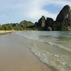
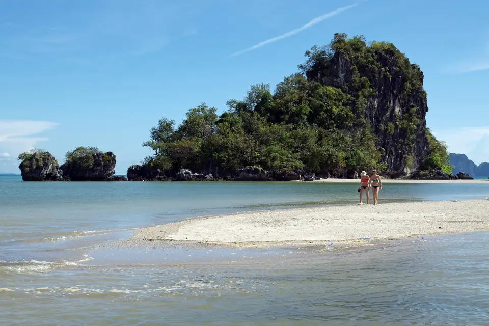
Nopparat Thara occupies a strip of golden sand in the Ao Nang subdistrict, 18 km from Krabi Town, shaded by groves of casuarinas and popular with Thai families out for a picnic. Its old popular name, Hat Khlong Haeng, “dry canal beach”, describes the essentials: at low tide the canal that comes down from the northern hills runs out of water and leaves a wide strip of sand running into the sea.
Behind the sands hides a larger scale. At the north end stands the headquarters of Hat Noppharat Thara–Mu Ko Phi Phi National Park, created in 1983, which covers some 388 km² as far as the Phi Phi Islands. On the seafront, moreover, a giant conch 7.5 m high portrays an edible mollusc that is a typical delicacy of Krabi.
Highlights
- Hoi chak tin — a 7.5 m sculpture on the seafront
- Low tide — exposed sand and mud, with Pacific reef herons
- Islets opposite the park headquarters, reachable on foot at low tide
- National park of 1983 — about 388 km² as far as the Phi Phi Islands
- River pier — long-tails and speedboats to Phuket and other islands
What to see at Nopparat Thara Beach in Krabi begins with a paradox: a beach defined by the water that leaves. Three kilometres of sand and casuarinas north of Ao Nang, with Thai picnics in the shade, which at low tide are left almost without sea and open paths to the islets. Behind that family-beach look, the history of Nopparat Thara brings together a jeweller’s name, a sculpture costing 8.5 million baht, the mainland edge of a national park that reaches as far as Phi Phi and an absence that cannot be seen at a glance. The full route, of about 45 minutes, is best enjoyed with the audio guide on the beach itself. It is the northern neighbour of Ao Nang Beach in the same bay, and the geology of this Krabi coast has its other face in the Fossil Shell Cemetery.
A giant conch that moves in leaps
Wing Shell
Summary of this stop
The first stop is at the giant conch square, on the Ban Khlong Haeng seafront, with parking all around. The hoi chak tin sculpture is 7.5 m high with a base of 6 x 14 m, and was erected by the Ao Nang TAO as part of the “Krabi, City of Art” policy. It cost 8,540,900 baht and was built between 24 November 2020 and 20 August 2021, on a 270-day contract.
The animal depicted is Laevistrombus canarium, an edible sea snail that is a typical delicacy of Krabi and is found only in the seas of Krabi and neighbouring provinces. In Thai it has two other popular names: hoi sang tin diao, “one-footed conch”, and hoi sang kradot, “jumping conch”. The names portray the way it moves: it digs its sickle-shaped operculum into the sand, stretches out its foot and throws the shell forward in leaps, more often when a predator is nearby. It is also the official aquatic animal of Krabi province.
The village, Ban Khlong Haeng, keeps the old name of the “dry canal”. The work was not free of controversy either: in 2021, in the midst of the pandemic, it was criticised that this money was not spent on vaccines for local residents, and the TAO mayor replied that it was a tourism development budget line, approved in a local consultation, which could not be used for that purpose. What is most surprising about this motionless giant is revealed by listening to it right there, with the conch in front of you.
The low tide that gave the beach its name
Row of casuarinas
Summary of this stop
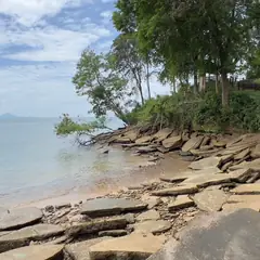
The second stop is beneath the row of casuarinas, facing the sea. It is the shade where picnics are set up, on a beach of 3 km of golden sand, although sources fluctuate between “more than 1 km”, “almost 3 km” and “3 km”. Hat Khlong Haeng, “dry canal beach”, was the old popular name: at low tide the canal that comes down from the northern hills runs out of water and leaves a wide strip of sand running into the sea.
On those sand and mud flats Pacific reef herons (Egretta sacra) can be seen all year round in both their dark and white morphs, and the collared kingfisher dives to hunt small crabs. The official name, Nopparat Thara (นพรัตน์ธารา), belongs to another register: it joins nopparat, the “nine gems” of Thai tradition (diamond, ruby, emerald, yellow sapphire, garnet, dark sapphire, pearl, zircon and cat’s eye), and thara, “stream” or “brook”. That is, “the stream of the nine gems”.
Two names for the same watercourse: one from the locals, who speak of a canal without water, and another learned, which turns it into a brook of nine precious stones. Which of the two does more justice to the channel at low tide is left to whoever observes it on the spot.
A national park that lost its turtles
Headquarters Hat Noppharat Thara - Mu Ko Phi Phi National Park
Summary of this stop
At the north end of the beach stands the headquarters of Hat Noppharat Thara–Mu Ko Phi Phi National Park, with its administration buildings. Opposite it, three islets emerge, and the nearest can be reached on foot at low tide. According to the park chief in July 2020, Worapot Lomlim, the beach here has shallow water and at low tide one can walk to the 2 islands in front of it, depending on each day’s tide timetable; an ornithological source, by contrast, speaks of three islets of which only the nearest is accessible on foot.
The park was created on 6 October 1983 as an IUCN category II protected area, with coral reefs, and covers 242,437 rai, about 388 km², from this mainland beach to the Phi Phi Islands. Between October 2015 and August 2016 it earned more than any other of Thailand’s 147 national parks: 502,780,516 baht.
A loss slips into that pride. Although the beach forms part of a national park, the mainland strip is full of hotels, shops and other buildings, and sea turtles can no longer nest on it, as has happened on many similar beaches in the region. Protected on paper since 1983 and closed to the turtles that once came up to lay their eggs: what is missing from this sand counts as much as what can be seen.
The river that leads to Phi Phi
Noppharat Thara Pier
Summary of this stop
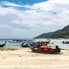
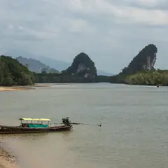
The last stop reaches the start of the Nopparat Thara pier. A river splits the beach into two halves and on it lies the Hat Nopparat Thara pier, from which long-tails and speedboats leave for Phuket and other islands, with crews preparing departures. The western half already belongs to the neighbouring subdistrict of Nong Thale and is almost all forest.
That river is the gateway to the island part of the same park. In the 2004 tsunami, of some 10,000 people who were on the Phi Phi Islands, 850 died and 1,200 were left missing, a memory that accompanies the routine of the boats.
There is also a warning that the sand does not let one see. The shoal that joins the navigation channel ends in an abrupt step into deep water with a fast current, and in 2020 the park asked people to avoid swimming at that point and to keep an eye on children. The details of that look towards the open sea are completed by the narration at the pier itself.